
1972 · Community
1972: Section 1 and the Willow Run Map
A sheet dated August 1968 was not recorded until June 1972. It shows the lots along Willow Run Drive near the entrance, between a fairway and a proposed lake.
Timeline
Aug. 1968
Date on the sheet "Section 1, Map of Brierwood Golf Club Estates," by V. W. Herlevich.
Nov. 5, 1971
Contract and agreement involving Brierwood Golf Club, Inc. recorded (Book 211, Page 831; index entry only).
June 15, 1972
Date of the clerk's certificate on the sheet (the community's history gives this as the recording date).
June 16, 1972, 10:00 a.m.
Recorded in Map Book 11, Page 24.[Map Book 11, p. 24]
Oct. 24, 1972
Agreement with Waccamaw Bank & Trust Co. recorded (Book 277, Page 310; index entry only).
Document links open for registered members who are signed in. The plat images on this page are public records shown for everyone.
Section 1, "Map of Brierwood Golf Club Estates," was recorded on June 16, 1972 at 10:00 a.m. in Map Book 11, Page 24, more than three years after Section 2. The clerk's certificate on the sheet is dated June 15, which is the date the community's history gives; the county's recording stamp says June 16.
The sheet is dated August 1968, drawn by the same surveyor, V. W. Herlevich, at 1 inch to 100 feet. It shows lots 1 through 19 on both sides of Willow Run Drive and a short side street, between a golf fairway and a "proposed lake," with the state road to Shallotte (S.R. 1143) at the left edge.
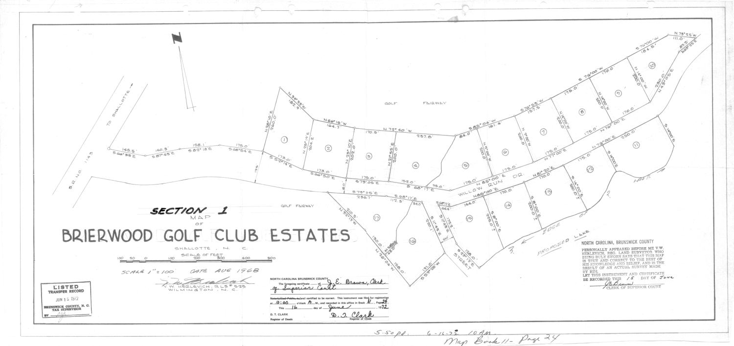
The August 1968 date deserves a second look. The 1969 Declaration refers to an unrecorded "Willow Run Subdivision" map dated August 1968 by the same surveyor, covering lots 1 through 17. This Section 1 sheet carries the same month, the same surveyor and the Willow Run name, but shows 19 lots. The records do not say whether it is the same drawing; it may be a later version. Either way, the lots were laid out in 1968 and recorded only in 1972.
By 1972 the first nine holes had been open for a couple of years and lot sales had shown there was demand, so mapping the entrance road made the project look like a community rather than a course with a few houses attached. The community's history places these lots "from the front entrance to the clubhouse." The article Section 1: Brierwood Road, from the Entrance to the Clubhouse follows them.
Around the recording the lenders were active: the county's index lists agreements with Waccamaw Bank & Trust Co. recorded October 24, 1972 (Book 277, Page 310) and October 9, 1973 (Book 300, Page 176). Those are index entries only; the pages themselves have not been read for this series.