
1967–2019 · Community & course
Overview: The Creation of Brierwood Estates in One Timeline
A ten-part series built on recorded deeds, covenants and plats. This first part gives the whole timeline and links to each chapter.
Timeline
Sept. 15 to Oct. 13, 1967
An option, a contract and a deed bring the land to B. B. and Jamie B. Ward. Chapter: 1967, the land[Option · Deed]
Jan. 22 to Jan. 31, 1969
Brierwood Golf Club, Inc. takes title to about 572 acres. Chapter: 1969, the corporation[Deed]
Jan. 26 and Feb. 12, 1969
The Declaration of Restrictions is signed and recorded. Chapter: the Declaration[Declaration]
May 1, 1969
Section 2 (Queens Grant Circle) is the first residential map recorded. Chapter: Section 2[Map Book 9, p. 94]
June 16, 1972
Section 1 is recorded. Chapter: Section 1[Map Book 11, p. 24]
Oct. 15 and Oct. 31, 1973
One plat for most of the community is drawn, then recorded. Chapter: the 1973 plat[Sheets 1 to 4]
July 29, 1974 and Nov. 13, 1975
Brierwood Village condominiums and the Office Tract are mapped; the second nine holes are finished about 1975. Chapter: 1974 to 1975[Village map · Office Tract]
1984 to 1989
The golf club parcel is mapped, Sections J, K, L and N are revised, the Villas condominiums begin, and the Town annexes a few lots. Chapter: 1983 to 1989[Golf club map · Sections J, K, L, N · Annexed areas]
1991 to 2019
A pool association, a long run of small plat revisions, the 2014 sale and the 2019 waiver of the developer's right of first purchase. Chapter: 1991 to 2019[2019 waiver]
Document links open for registered members who are signed in. The plat images on this page are public records shown for everyone.
This series follows how Brierwood Estates and its golf club were created, using the documents recorded at the Brunswick County Register of Deeds and kept by the Town of Shallotte: deeds, a declaration of covenants, and a long run of plats. Each part has its own timeline at the top, links to the documents it relies on, and the plats in the order they were recorded. The documents open for registered members who are signed in; the plat images are shown here for everyone.
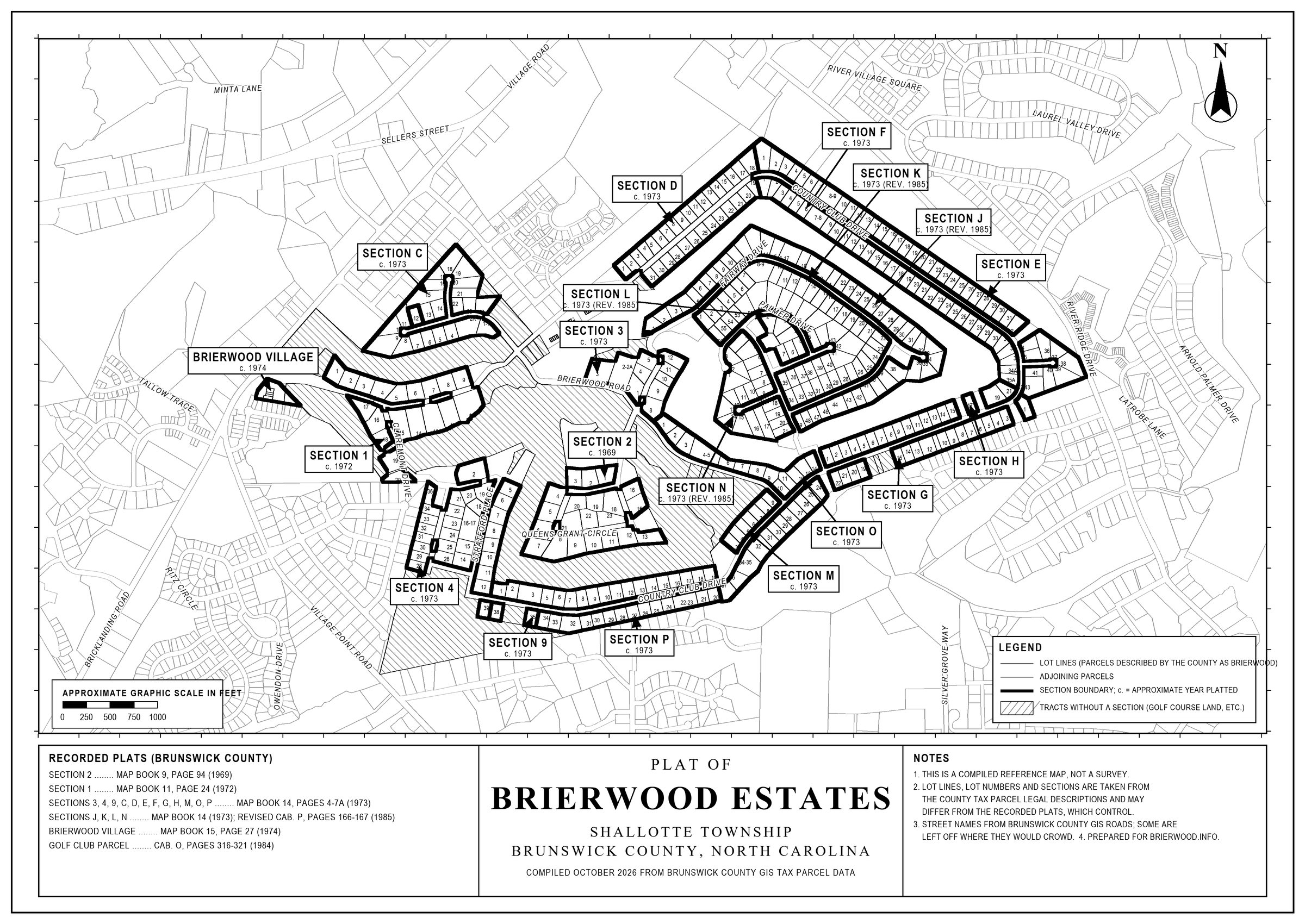
The story in one line: a land purchase in 1967; a corporation and a set of covenants in 1969; three residential maps in 1969, 1972 and 1973 that laid out most of the community; condominiums and revised sections in the 1970s and 1980s; and a long period of lot sales, small revisions and waivers that runs to the present.
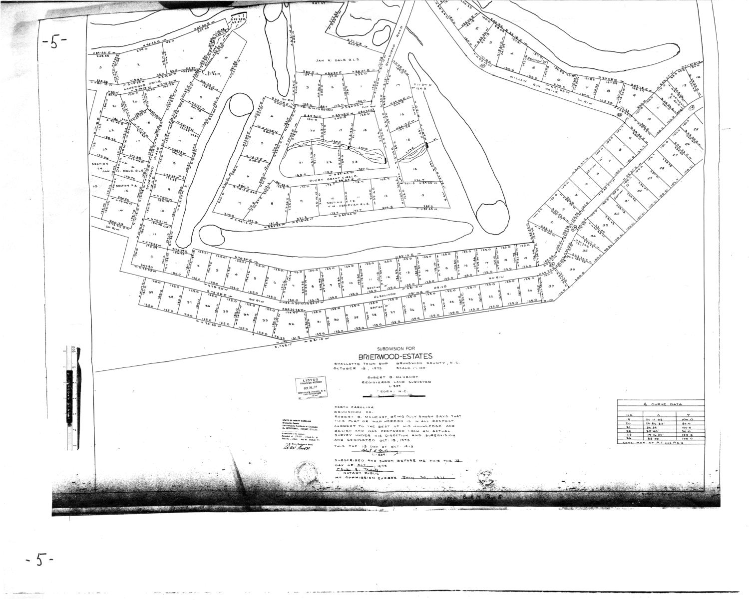
The plat below, the center of the story, is the 1973 plat. Drawn on October 15, 1973 and recorded on October 31, it shows most of the lots, streets and fairways of the community on four large sheets. Almost every later map refers back to it. Sheet 2, shown here, carries the title block and the Queens Grant Circle area.
A few conventions help in reading the series. Dates are recording dates unless the text says otherwise. "Book 205, Page 222" means a recorded document, "Map Book 14, Pages 4 to 7" a recorded plat. Where the community's own history gives a different date or count, for example June 15 against June 16, 1972 for Section 1, or "nine maps" for the 1973 plat, the chapter says so. The full list of recordings behind the series is the Documents Index.
Everything here is drawn from the documents themselves, not from memory. These are research summaries, not a legal opinion or title search; the recorded documents control.