
1974–1975 · Community & course
1974–1975: Brierwood Village, the Office Tract and a Second Nine
A condominium map, a small office lot and the finishing of the second nine holes.
Timeline
Mar. 7 and Apr. 3, 1974
Agreements and a lease filed under the name "Brierwood Golf Club" (Book 307, Page 700; Book 309, Pages 59 and 62; index entries only).
1974
Two deeds of trust, each described as 572 acres (Book 307, Page 696; Book 308, Page 557; index entries only).
June 1974
Date of the map "Brierwood Village Condominiums," drawn by Robert B. McHenry.
July 29, 1974, 2:10 p.m.
Map recorded in Map Book 15, Page 27, and the covenants, restrictions and easements for Brierwood Village recorded (Book 315, Page 504).[Map · Covenants]
About 1975
The second nine holes are completed and become the front nine (community history).
Oct. 21, 1975
Survey date of "Additions to Brierwood Estates" by Jan K. Dale.
Nov. 13, 1975, 3:35 p.m.
Recorded in Map Cabinet H, Page 59: the Office Tract and Lot 1A.[Office Tract map · Second copy]
Document links open for registered members who are signed in. The plat images on this page are public records shown for everyone.
By 1974 the community was being built out, and the company turned to a new kind of property. A June 1974 map, "Brierwood Village Condominiums," drawn by Robert B. McHenry at 1 inch to 40 feet, shows Building No. 1 with four units (Units 1 through 4) and four lots surrounded by common area, between Willow Run Drive and the state road. It was recorded on July 29, 1974 at 2:10 p.m. in Map Book 15, Page 27, the same day as the covenants, restrictions and easements for Brierwood Village (Book 315, Page 504).
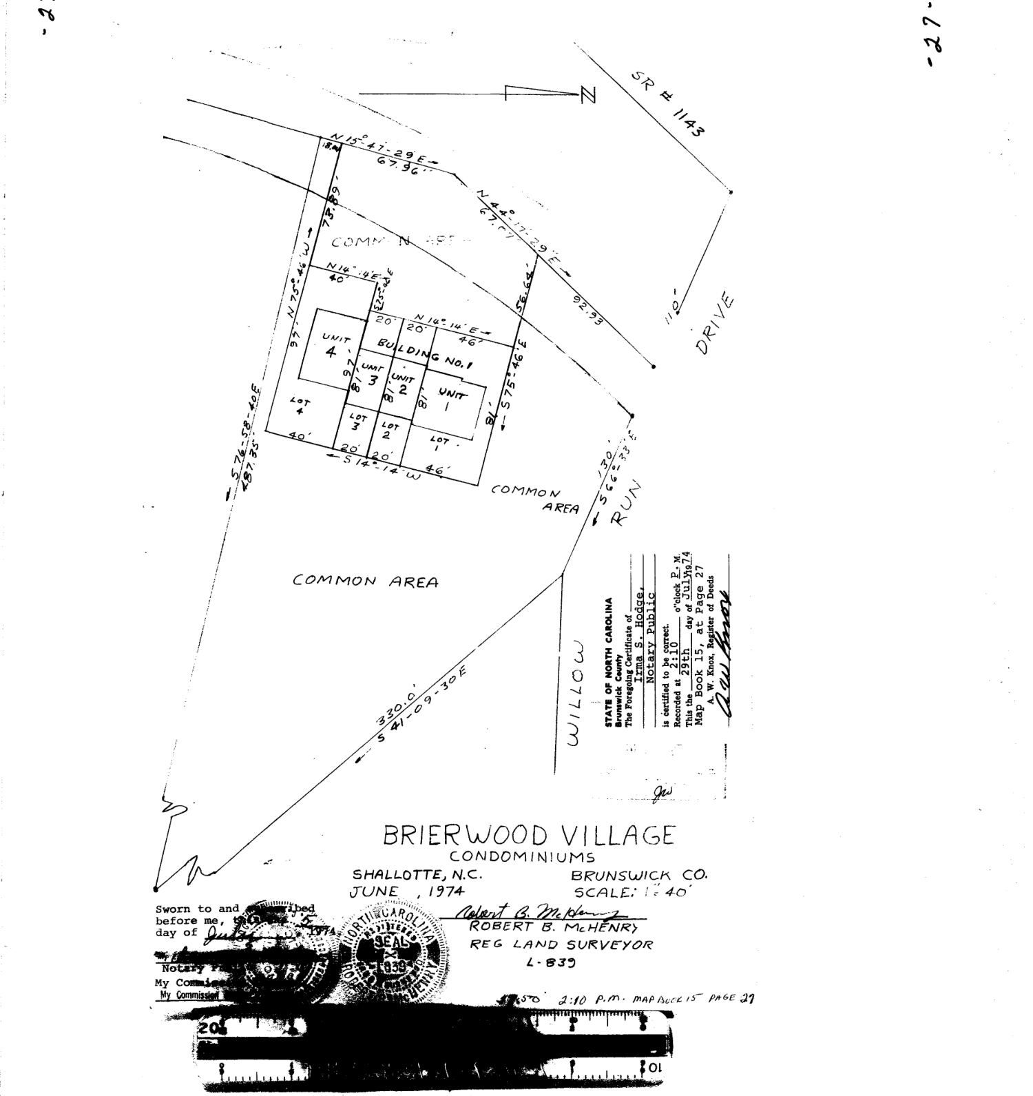
Earlier that spring the company had recorded agreements and a lease under the name "Brierwood Golf Club" (March 7 and April 3, 1974: Book 307, Page 700 and Book 309, Pages 59 and 62), and in 1974 two deeds of trust, each described as 572 acres (Book 307, Page 696 and Book 308, Page 557). These are index entries; the pages have not been read for this series. They show the land was still being financed as one large property while the first condominium units were mapped.
The golf course grew in the same years. The community's history says the final nine holes were completed during or around 1975 and became the front nine, moving the original 1969 holes to the back. That is the layout golfers knew for the next four decades.
A small map recorded on November 13, 1975 at 3:35 p.m. in Map Cabinet H, Page 59, titled "Additions to Brierwood Estates" and drawn by Jan K. Dale of Shallotte from a survey sworn on October 21, 1975, adds two things to the 1973 plat: a 100-foot-square Office Tract at the corner of Elsolindo Drive and Willow Run Drive in Section 3, and a Lot 1A split from Lot 1 of Section C. A 2007 administrative record (Book 2677, Page 1175) later corrected the grantor in the county's index entry for this map.
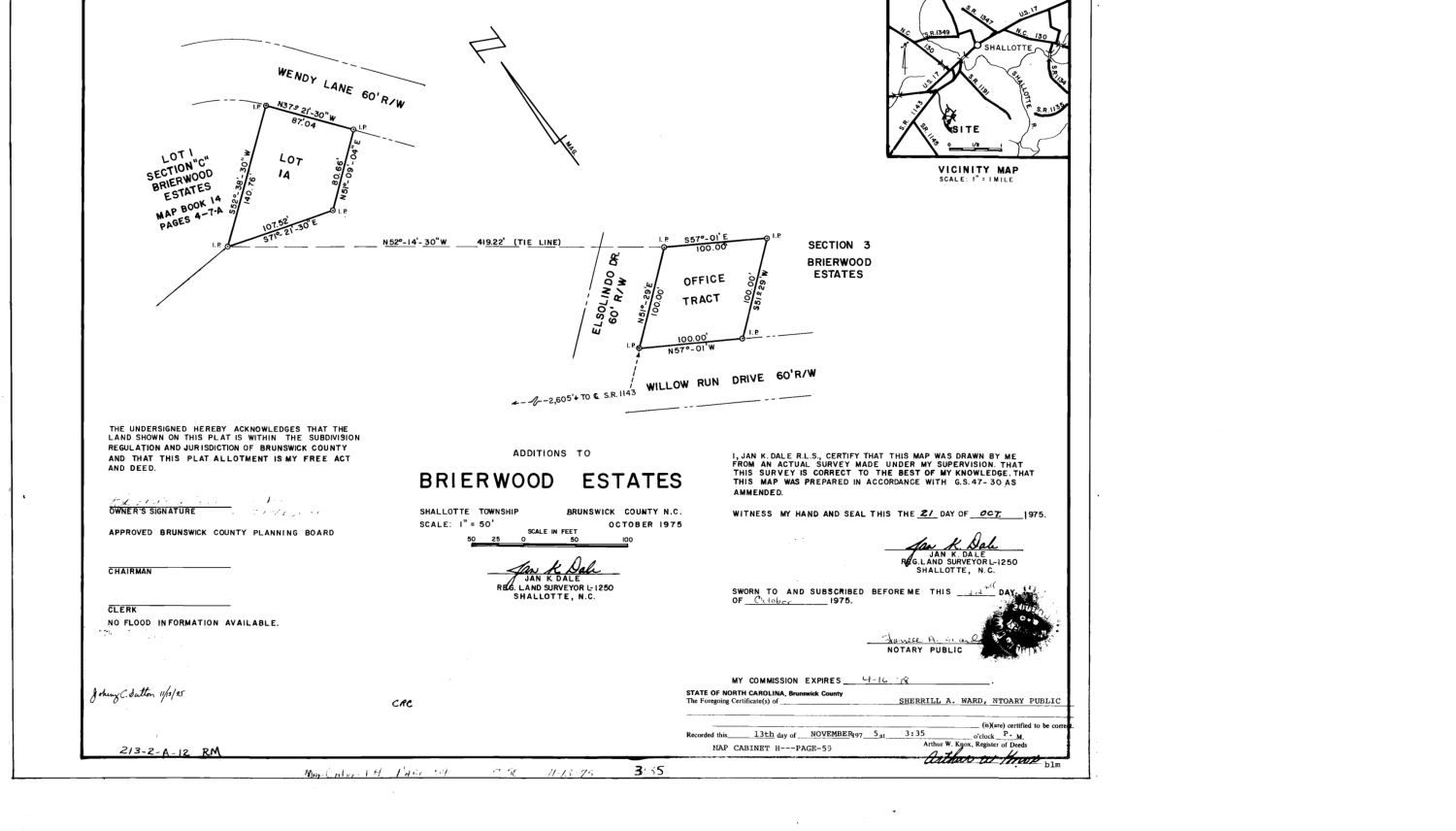
Both maps are small, but they show how the 1973 plat was used afterward: not as a finished picture, but as the base on which individual lots were split, added and sold.